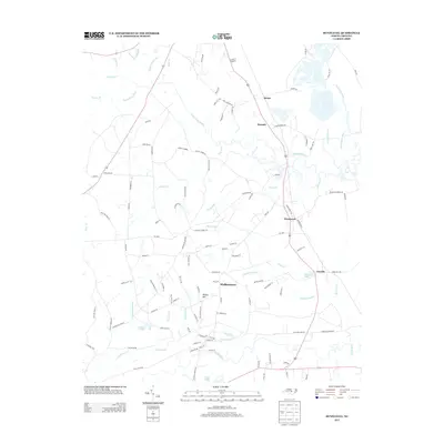
2013 Map of Bunnlevel
USGS Topo · Published 2013About this map
Bunnlevel and the surrounding Harnett County countryside are defined by a complex network of blackwater streams and wetlands. The Upper Little River and the Little River meander through the landscape, fed by numerous tributaries such as McLean Cr and Duncans Cr. These waterways are flanked by significant marshy areas, including Big Swamp, Gum Swamp, and Williams Swamp, illustrating the low-lying, hydrologically active nature of this region.
Find a feature on this map
117 named features on this map. Tap any name to fly to it.
Don’t see what you’re looking for? This feature index may not catch every label — zoom into the map to look around manually.
Map Details
Editions of this 2013 Bunnlevel Map
This is the sole edition of this map. No revisions or reprints were ever made.
Other maps of this area

1948 · Fayetteville
USGS Topo · 1:62,500

1948 · Slocomb
USGS Topo · 1:24,000

1950 · Manchester
USGS Topo · 1:24,000

1950 · Slocomb
USGS Topo · 1:24,000

1953 · Raleigh
USGS Topo · 1:250,000

1954 · Raleigh
USGS Topo · 1:250,000

1956 · Anderson Creek
USGS Topo · 1:24,000

1956 · Bunnlevel
USGS Topo · 1:24,000
1957 · Manchester
USGS Topo · 1:24,000

1957 · Fayetteville
USGS Topo · 1:62,500