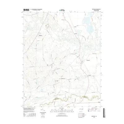
2016 Map of Bunnlevel
USGS Topo · Published 2016About this map
The Upper Little River and Little River meander through this portion of Harnett County, defining a landscape of low-lying wetlands and established rural communities. The unincorporated settlement of Bunnlevel serves as a central point, surrounded by numerous family-named roads and landmarks that reflect a deep-rooted local history. Further south, the map captures the transition into Cumberland County near Linden, where the river system continues to influence land use and property boundaries.
Find a feature on this map
95 named features on this map. Tap any name to fly to it.
Don’t see what you’re looking for? This feature index may not catch every label — zoom into the map to look around manually.
Map Details
Editions of this 2016 Bunnlevel Map
This is the sole edition of this map. No revisions or reprints were ever made.
Other maps of this area

1948 · Fayetteville
USGS Topo · 1:62,500

1948 · Slocomb
USGS Topo · 1:24,000

1950 · Manchester
USGS Topo · 1:24,000

1950 · Slocomb
USGS Topo · 1:24,000

1953 · Raleigh
USGS Topo · 1:250,000

1954 · Raleigh
USGS Topo · 1:250,000

1956 · Anderson Creek
USGS Topo · 1:24,000

1956 · Bunnlevel
USGS Topo · 1:24,000
1957 · Manchester
USGS Topo · 1:24,000

1957 · Fayetteville
USGS Topo · 1:62,500