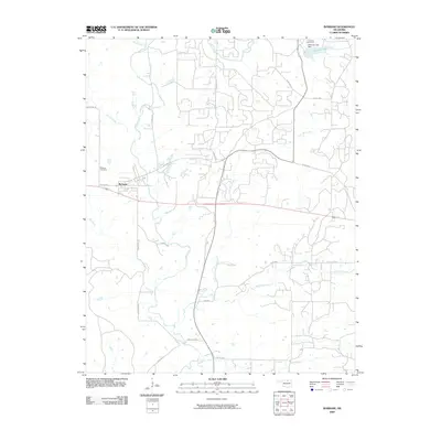
2009 Map of Burbank
USGS Topo · Published 2009About this map
Burbank serves as the primary settlement on this Osage County landscape, situated at the intersection of South Ave and what was once Old Hwy 60. The surrounding terrain is defined by a dense network of watercourses, including the meandering Salt Creek and its many tributaries like Stewart Creek and Mud Creek. In the northeast, the Charlotte Lake Dam creates Charlotte Lake, bordered by the Lakeview Golf Course, suggesting a pocket of recreation amidst the agricultural and ranching expanses.
Find a feature on this map
27 named features on this map. Tap any name to fly to it.
Don’t see what you’re looking for? This feature index may not catch every label — zoom into the map to look around manually.
Map Details
Editions of this 2009 Burbank Map
This is the sole edition of this map. No revisions or reprints were ever made.
Other maps of this area

1916 · Foraker
USGS Topo · 1:62,500

1932 · Fairfax
USGS Topo · 1:62,500

1935 · Kaw
USGS Topo · 1:62,500

1936 · Belford
USGS Topo · 1:62,500

1955 · Enid
USGS Topo · 1:250,000

1958 · Enid
USGS Topo · 1:250,000

1964 · Charley Creek NE
USGS Topo · 1:24,000

1964 · Kaw City
USGS Topo · 1:24,000
1964 · Shidler
USGS Topo · 1:24,000
1973 · Foraker South
USGS Topo · 1:24,000