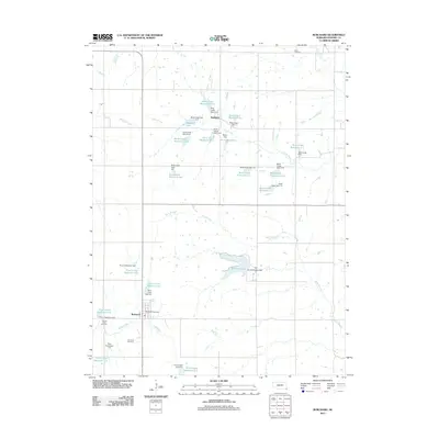
2011 Map of Burchard
USGS Topo · Published 2011About this map
Burchard serves as the primary settlement on this Nebraska landscape, where agricultural land use is defined by an extensive network of water management features. The area is characterized by numerous small-scale reservoirs and dams along the tributaries of Rock Creek and Plum Creek, such as the Wenzl Reservoir and Rock Creek Reservoir 23-A. These structures signify a highly engineered approach to soil conservation and water retention in Pawnee County.
Find a feature on this map
45 named features on this map. Tap any name to fly to it.
Don’t see what you’re looking for? This feature index may not catch every label — zoom into the map to look around manually.
Map Details
Editions of this 2011 Burchard Map
This is the sole edition of this map. No revisions or reprints were ever made.
Other maps of this area

1955 · Lincoln
USGS Topo · 1:250,000

1957 · Lincoln
USGS Topo · 1:250,000

1958 · Lincoln
USGS Topo · 1:250,000

1965 · Pawnee City
USGS Topo · 1:24,000

1965 · Crab Orchard
USGS Topo · 1:24,000

1965 · Burchard
USGS Topo · 1:24,000

1965 · Tecumseh
USGS Topo · 1:24,000
1965 · Steinauer
USGS Topo · 1:24,000
1965 · Liberty SE
USGS Topo · 1:24,000

1965 · Lewiston
USGS Topo · 1:24,000