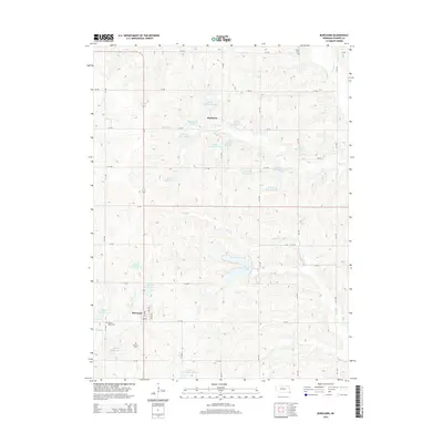
2014 Map of Burchard
USGS Topo · Published 2014About this map
Burchard and Mayberry anchor this portion of Pawnee County, illustrating a landscape defined by intricate water management and agricultural grid lines. The central feature is Burchard Lake, a significant water body fed by the winding Balls Br and surrounded by a network of smaller impoundments such as Wenzl Reservoir and numerous Rock Creek and Plum Creek reservoirs. These man-made features highlight the region's 21st-century focus on soil conservation and water storage within the Rock Cr and Plum Cr drainages.
Find a feature on this map
42 named features on this map. Tap any name to fly to it.
Don’t see what you’re looking for? This feature index may not catch every label — zoom into the map to look around manually.
Map Details
Editions of this 2014 Burchard Map
This is the sole edition of this map. No revisions or reprints were ever made.
Other maps of this area

1955 · Lincoln
USGS Topo · 1:250,000

1957 · Lincoln
USGS Topo · 1:250,000

1958 · Lincoln
USGS Topo · 1:250,000

1965 · Pawnee City
USGS Topo · 1:24,000

1965 · Crab Orchard
USGS Topo · 1:24,000

1965 · Burchard
USGS Topo · 1:24,000

1965 · Tecumseh
USGS Topo · 1:24,000
1965 · Steinauer
USGS Topo · 1:24,000
1965 · Liberty SE
USGS Topo · 1:24,000

1965 · Lewiston
USGS Topo · 1:24,000