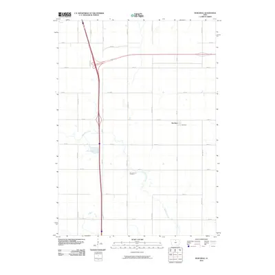
2010 Map of Burchinal
USGS Topo · Published 2010About this map
Burchinal anchors this rural landscape in south-central Cerro Gordo County, reflecting a classic Midwestern grid pattern defined by a network of local roads such as Jonquil Ave and Lark Ave. The terrain is shaped by the subtle drainage of Beaverdam Creek, which meanders through the eastern section of the map, and the distinctive Zerbel Slough to the west. This 2010 survey illustrates the modernization of Iowa's agricultural corridors, with the north-south interstate infrastructure cutting directly through the traditional section-line layout. Local history and genealogy interests are centered at Mount Vernon Cemetery, situated near the banks of a creek branch south of the main settlement. The map provides a precise account of the area's rural road nomenclature, from 170th St in the south to 240th St in the north, showing how contemporary transportation networks have integrated with the historic farmstead arrangement.
Find a feature on this map
22 named features on this map. Tap any name to fly to it.
Don’t see what you’re looking for? This feature index may not catch every label — zoom into the map to look around manually.
Map Details
Editions of this 2010 Burchinal Map
This is the sole edition of this map. No revisions or reprints were ever made.
Other maps of this area

1954 · Mason City
USGS Topo · 1:250,000

1954 · Waterloo
USGS Topo · 1:250,000

1955 · Waterloo
USGS Topo · 1:250,000

1957 · Mason City
USGS Topo · 1:250,000

1958 · Mason City
USGS Topo · 1:250,000

1959 · Mason City
USGS Topo · 1:24,000

1959 · Mason City
USGS Topo · 1:62,500

1959 · Hanford
USGS Topo · 1:24,000

1972 · Clear Lake West
USGS Topo · 1:24,000

1972 · Thornton
USGS Topo · 1:24,000