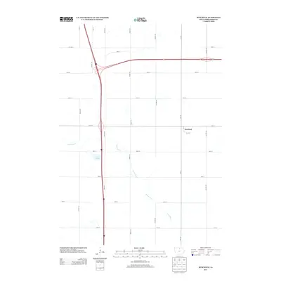
2013 Map of Burchinal
USGS Topo · Published 2013About this map
Burchinal remains the central settlement in this portion of Cerro Gordo County, surrounded by a structured grid of rural roads named for native birds and local flora. The landscape is defined by the winding course of Beaverdam Cr, which meanders through the eastern and southern sections of the quadrangle. In the center, Zerbel Slough occupies a low-lying area west of Indigo Ave, illustrating the glacial topography of northern Iowa. The road network is heavily influenced by modern thoroughfares, including the intersection of Interstate 35 and U.S. Highway 18 in the northwest, which provides a contrast to the secondary local roads like Mallard Ave and Killdeer Ave. This survey records the rural layout of the region, where residential clusters are primarily concentrated along the intersection of 210th St and 1st St.
Find a feature on this map
22 named features on this map. Tap any name to fly to it.
Don’t see what you’re looking for? This feature index may not catch every label — zoom into the map to look around manually.
Map Details
Editions of this 2013 Burchinal Map
This is the sole edition of this map. No revisions or reprints were ever made.
Other maps of this area

1954 · Mason City
USGS Topo · 1:250,000

1954 · Waterloo
USGS Topo · 1:250,000

1955 · Waterloo
USGS Topo · 1:250,000

1957 · Mason City
USGS Topo · 1:250,000

1958 · Mason City
USGS Topo · 1:250,000

1959 · Mason City
USGS Topo · 1:24,000

1959 · Mason City
USGS Topo · 1:62,500

1959 · Hanford
USGS Topo · 1:24,000

1972 · Clear Lake West
USGS Topo · 1:24,000

1972 · Thornton
USGS Topo · 1:24,000