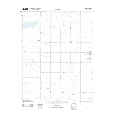
2012 Map of Burden
USGS Topo · Published 2012About this map
The town of Burden serves as the primary hub of this Cowley County landscape, where the local economy is defined by a grid of rural roads and active energy extraction. Numerous designated production areas, including the Burden Oil Field, Shannon Oil Field, and Frog Hollow Oil Field, are scattered across the terrain, illustrating the importance of petroleum to the region during this era. The section-line road network connects these industrial sites to the town center, which is anchored by streets like North Main St and South Oak St.
Find a feature on this map
45 named features on this map. Tap any name to fly to it.
Don’t see what you’re looking for? This feature index may not catch every label — zoom into the map to look around manually.
Map Details
Editions of this 2012 Burden Map
This is the sole edition of this map. No revisions or reprints were ever made.
Other maps of this area

1889 · Burden
USGS Topo · 1:125,000

1955 · Wichita
USGS Topo · 1:250,000

1958 · Wichita
USGS Topo · 1:250,000

1962 · Dexter
USGS Topo · 1:24,000

1962 · Cambridge
USGS Topo · 1:24,000

1964 · Cambridge NW
USGS Topo · 1:24,000

1964 · Burden
USGS Topo · 1:24,000
1964 · Atlanta
USGS Topo · 1:24,000

1965 · Eaton
USGS Topo · 1:24,000

1965 · Winfield
USGS Topo · 1:24,000