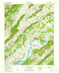
1961 Map of Burem
USGS Topo · Published 1964About this map
The Holston River winds through this 1961 topographic study of eastern Tennessee, defining a landscape shaped by river transport and valley agriculture. The industrial presence of the John Sevier Steam Plant and the adjacent John Sevier Detention Reservoir at the western edge of Cherokee Lake marks the era's infrastructure expansion. Along the river's northern banks, small communities like Petersburg and Burem are connected by the Southern Railway and the Lee Highway.
Find a feature on this map
70 named features on this map. Tap any name to fly to it.
Don’t see what you’re looking for? This feature index may not catch every label — zoom into the map to look around manually.
Map Details
Editions of this 1961 Burem Map
3 editions found
Other maps of this area

1883 · Morristown
USGS Topo · 1:125,000

1887 · Jonesville
USGS Topo · 1:125,000

1891 · Jonesville
USGS Topo · 1:125,000

1892 · Greeneville
USGS Topo · 1:125,000

1893 · Morristown
USGS Topo · 1:125,000

1894 · Estillville
USGS Topo · 1:125,000

1895 · Morristown
USGS Topo · 1:125,000

1896 · Greeneville
USGS Topo · 1:125,000

1904 · Greeneville
USGS Topo · 1:125,000

1935 · Surgoinsville
USGS Topo · 1:48,000