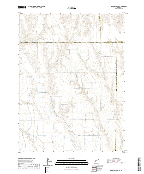
2021 Map of Burger Canyon SE
USGS Topo · Published 2021About this map
The agricultural landscape of Hitchcock County is defined by a sophisticated network of irrigation infrastructure and rural landmarks as it appeared in the early 2020s. Centered on the Culbertson Extension Canal and the Culbertson Canal, the map illustrates how water management has shaped this corner of Nebraska. The terrain is marked by the winding path of Blackwood Creek and the notable Burger Canyon in the northern reaches, while the presence of the Blackwood Lateral Canal highlights the intense engineering required for local farming. Cultural markers like Hock Airport and Miller Reservoir serve as fixed points of reference in a region where the borders of Hayes, Frontier, and Red Willow counties all converge. This map provides a clear view of the section lines and rural road grids that organize the high plains.
Find a feature on this map
36 named features on this map. Tap any name to fly to it.
Don’t see what you’re looking for? This feature index may not catch every label — zoom into the map to look around manually.
Map Details
Editions of this 2021 Burger Canyon SE Map
This is the sole edition of this map. No revisions or reprints were ever made.
Other maps of this area

1954 · McCook
USGS Topo · 1:250,000

1957 · McCook
USGS Topo · 1:250,000

1958 · McCook
USGS Topo · 1:250,000

1962 · Culbertson NW
USGS Topo · 1:24,000

1970 · Red Willow Dam
USGS Topo · 1:24,000

1970 · Quick
USGS Topo · 1:24,000
1970 · Culbertson
USGS Topo · 1:24,000

1970 · McCook West
USGS Topo · 1:24,000

1970 · Burger Canyon SE
USGS Topo · 1:24,000

1970 · Burger Canyon East
USGS Topo · 1:24,000