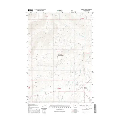
2015 Map of Burgess Junction
USGS Topo · Published 2015About this map
Burgess Junction serves as the central focal point of this high-altitude landscape within the Bighorn National Forest. The map detail reveals a complex network of forest routes, including Primary Forest Rte 15 and Forest Rte 155, which facilitate access through this mountain terrain. The hydrology is dominated by the headwaters of the North Tongue River and the Dry Fork Little Bighorn River, illustrating the continental drainage patterns of the Bighorn Mountains. Distinctive geographic features such as the Garden of the Gods and Twin Buttes stand out against the contour-rich topography. Notable parks and basins like Schuler Park, Bull Park, and the Fool Creek Basin indicate the diverse meadows and geological depressions that define this region of Wyoming.
Find a feature on this map
33 named features on this map. Tap any name to fly to it.
Don’t see what you’re looking for? This feature index may not catch every label — zoom into the map to look around manually.
Map Details
Editions of this 2015 Burgess Junction Map
This is the sole edition of this map. No revisions or reprints were ever made.
Other maps of this area

1895 · Dayton
USGS Topo · 1:125,000

1898 · Bald Mountain
USGS Topo · 1:125,000

1901 · Dayton
USGS Topo · 1:125,000

1901 · Bald Mountain
USGS Topo · 1:125,000

1955 · Sheridan
USGS Topo · 1:250,000

1958 · Sheridan
USGS Topo · 1:250,000

1960 · Granite Pass
USGS Topo · 1:24,000

1960 · Hidden Tepee Creek
USGS Topo · 1:24,000

1962 · Sheridan
USGS Topo · 1:250,000
1964 · Burgess Junction
USGS Topo · 1:24,000