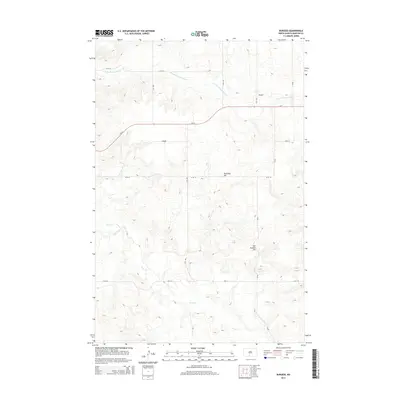
2014 Map of Burgess
USGS Topo · Published 2014About this map
Burgess serves as a central reference point in this corner of Morton County, where the high plains of North Dakota are carved by subtle drainage systems. The landscape is defined by the winding course of Louse Cr in the south and the E Fork Chanta Peta Cr to the north, creating a series of draws and rises typical of the region's topography. Notable elevations including Township Hill and Van Duesen Hill provide distinct landmarks across the section lines. The map captures a transition in the local infrastructure, with Nd-21 and Cr-82 intersecting amidst a grid of rural routes such as 64th St and 31st Ave, illustrating the enduring spatial organization of the state's agricultural heartland in the early 21st century.
Find a feature on this map
14 named features on this map. Tap any name to fly to it.
Don’t see what you’re looking for? This feature index may not catch every label — zoom into the map to look around manually.
Map Details
Editions of this 2014 Burgess Map
This is the sole edition of this map. No revisions or reprints were ever made.
Other maps of this area

1907 · Bismarck
USGS Topo · 1:125,000

1954 · Bismarck
USGS Topo · 1:250,000

1958 · Bismarck
USGS Topo · 1:250,000

1971 · Solen SW
USGS Topo · 1:24,000

1971 · Timmer
USGS Topo · 1:24,000

1979 · Bismarck
USGS Topo · 1:100,000

1980 · Breien
USGS Topo · 1:24,000

1980 · Freda
USGS Topo · 1:24,000

1980 · Burgess
USGS Topo · 1:24,000
1980 · Linton
USGS Topo · 1:100,000