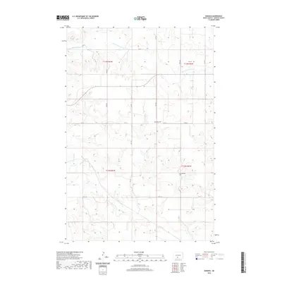
2020 Map of Burgess
USGS Topo · Published 2020About this map
Township Hill and Van Duesen Hill anchor this rural landscape in Morton County, where the terrain is defined by the drainage of the Chanta Peta Cr and its tributaries. The eastern edge of the survey area is marked by the meandering path of the E Fork Chanta Peta Cr, while Louse Cr winds through the southern reaches. This modern topographical study illustrates a late 20th-century development of the section-line road system, including routes like Co Rd 82 and Co Rd 134, which connect the high points and creek valleys. The map provides a clear look at the Public Land Survey System structure, delineating boundaries for T135N and T134N across ranges R83W and R82W, reflecting the enduring legacy of the rectangular survey system in the North Dakota plains.
Find a feature on this map
18 named features on this map. Tap any name to fly to it.
Don’t see what you’re looking for? This feature index may not catch every label — zoom into the map to look around manually.
Map Details
Editions of this 2020 Burgess Map
This is the sole edition of this map. No revisions or reprints were ever made.
Other maps of this area

1907 · Bismarck
USGS Topo · 1:125,000

1954 · Bismarck
USGS Topo · 1:250,000

1958 · Bismarck
USGS Topo · 1:250,000

1971 · Solen SW
USGS Topo · 1:24,000

1971 · Timmer
USGS Topo · 1:24,000

1979 · Bismarck
USGS Topo · 1:100,000

1980 · Breien
USGS Topo · 1:24,000

1980 · Freda
USGS Topo · 1:24,000

1980 · Burgess
USGS Topo · 1:24,000
1980 · Linton
USGS Topo · 1:100,000