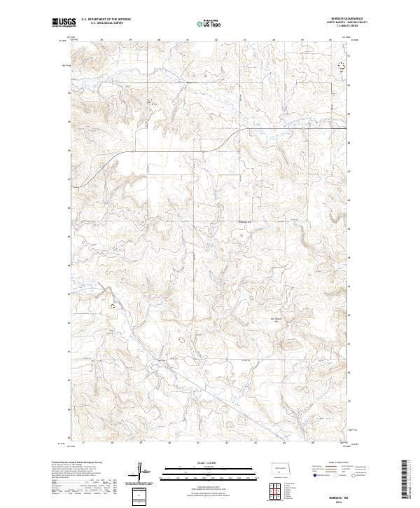
2024 Map of Burgess
USGS Topo · Published 2024About this map
Township Hill and Van Duesen Hill stand as prominent landmarks in this section of Morton County, where the high prairie begins to break into the drainage systems of the Missouri River basin. This survey illustrates a rural landscape defined by the winding course of the East Fork Chanta Peta Creek in the north and Louse Creek to the south. The land is organized into the rectangular survey blocks of T135N and T134N, with a sparse network of section-line roads such as 64th St and 70th St providing access to the interior. The map reveals the persistence of traditional prairie land use, where the intersection of Co Rd 83 and Co Rd 134 serves as a primary navigation point for this quiet agricultural region.
Find a feature on this map
14 named features on this map. Tap any name to fly to it.
Don’t see what you’re looking for? This feature index may not catch every label — zoom into the map to look around manually.
Map Details
Editions of this 2024 Burgess Map
This is the sole edition of this map. No revisions or reprints were ever made.
Other maps of this area

1907 · Bismarck
USGS Topo · 1:125,000

1954 · Bismarck
USGS Topo · 1:250,000

1958 · Bismarck
USGS Topo · 1:250,000

1971 · Solen SW
USGS Topo · 1:24,000

1971 · Timmer
USGS Topo · 1:24,000

1979 · Bismarck
USGS Topo · 1:100,000

1980 · Breien
USGS Topo · 1:24,000

1980 · Freda
USGS Topo · 1:24,000

1980 · Burgess
USGS Topo · 1:24,000
1980 · Linton
USGS Topo · 1:100,000