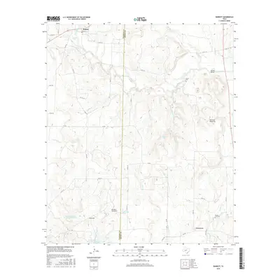
2016 Map of Burkett
USGS Topo · Published 2016About this map
Burkett sits at the northern edge of this West Texas landscape, where the boundary between Coleman and Brown counties divides a terrain of named ridges and creek drainages. The geography is defined by prominent elevations such as the Barefoot Mountains, the Holloway Mountains, and the distinct Red Knob. Water management and local resources are evident through features like the Soil Conservation Service Site 3 Reservoir and McReynolds Spring, which supported the ranching and agricultural life of the region. Genealogists and local historians will find the locations of Smith Cem and Panther Creek Cem particularly valuable for tracing early families. The network of drainage systems, including Pecan Bayou and its numerous tributaries like Gobbler Br and Cottonwood Br, illustrates the natural irrigation patterns that shaped the settlement of these highlands.
Find a feature on this map
47 named features on this map. Tap any name to fly to it.
Don’t see what you’re looking for? This feature index may not catch every label — zoom into the map to look around manually.
Map Details
Editions of this 2016 Burkett Map
This is the sole edition of this map. No revisions or reprints were ever made.
Other maps of this area

1887 · Coleman
USGS Topo · 1:125,000

1889 · Coleman
USGS Topo · 1:125,000

1924 · Coleman 1-a
USGS Topo · 1:48,000

1924 · Brownwood Reservoir Site
USGS Topo · 1:48,000

1927 · Grosvenor
USGS Topo · 1:62,500

1931 · Baird
USGS Topo · 1:125,000

1932 · Baird
USGS Topo · 1:125,000

1954 · Brownwood
USGS Topo · 1:250,000

1954 · Abilene
USGS Topo · 1:250,000

1958 · Abilene
USGS Topo · 1:250,000