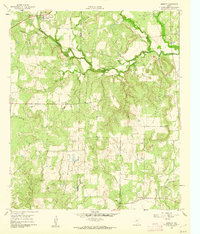
1960 Map of Burkett
USGS Topo · Published 1962About this map
The Coleman Co Brown Co line divides this Central Texas landscape, where the plateau gives way to the drainage of Pecan Bayou. Near the northern border, the community of Burkett sits adjacent to a local Cem, marking a hub of settlement in an area otherwise defined by ranching and resource extraction. The terrain is notably punctuated by the Holloway Mountains and Barefoot Mountains, alongside distinctive landmarks like Red Knob.
Find a feature on this map
21 named features on this map. Tap any name to fly to it.
Don’t see what you’re looking for? This feature index may not catch every label — zoom into the map to look around manually.
Map Details
Editions of this 1960 Burkett Map
This is the sole edition of this map. No revisions or reprints were ever made.
Other maps of this area

1887 · Coleman
USGS Topo · 1:125,000

1889 · Coleman
USGS Topo · 1:125,000

1924 · Coleman 1-a
USGS Topo · 1:48,000

1924 · Brownwood Reservoir Site
USGS Topo · 1:48,000

1927 · Grosvenor
USGS Topo · 1:62,500

1931 · Baird
USGS Topo · 1:125,000

1932 · Baird
USGS Topo · 1:125,000

1954 · Brownwood
USGS Topo · 1:250,000

1954 · Abilene
USGS Topo · 1:250,000

1958 · Abilene
USGS Topo · 1:250,000