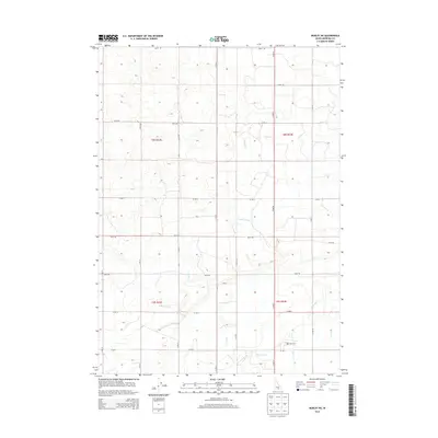
2013 Map of Burley NE
USGS Topo · Published 2013About this map
Agricultural development and irrigation infrastructure define this landscape in Minidoka County during the early 21st century. The map reveals an intricate network of water management features, including the H Main Drain, K Main Drain, and the D-Nine Drain, which serve the surrounding fields. These man-made channels, along with the C-1 Canal and C-2 Canal, illustrate the intensive engineering required to support farming in this region of Idaho. A primary cultural landmark is the Paul Cem, providing a focal point for genealogical research in the southern portion of the quadrangle. The terrain is further organized by a rigid grid of rural roads, such as 900 N RD and N 750 W, which delineate the township and range boundaries of t8s r22e and t9s r23e.
Find a feature on this map
26 named features on this map. Tap any name to fly to it.
Don’t see what you’re looking for? This feature index may not catch every label — zoom into the map to look around manually.
Map Details
Editions of this 2013 Burley NE Map
This is the sole edition of this map. No revisions or reprints were ever made.
Other maps of this area

1954 · Pocatello
USGS Topo · 1:250,000

1958 · Pocatello
USGS Topo · 1:250,000

1964 · Burley SW
USGS Topo · 1:24,000

1964 · Burley NE
USGS Topo · 1:24,000

1964 · Rupert NW
USGS Topo · 1:24,000

1964 · Burley NW
USGS Topo · 1:24,000

1964 · Rupert SW
USGS Topo · 1:24,000

1964 · Burley SE
USGS Topo · 1:24,000

1972 · Kimama
USGS Topo · 1:24,000
1972 · Kimama Butte
USGS Topo · 1:24,000