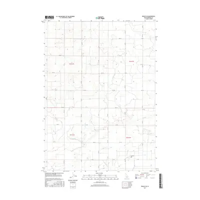
2017 Map of Burley NE
USGS Topo · Published 2017About this map
Agricultural irrigation networks define the landscape of Minidoka County in this 2017 survey. The region is heavily managed through a systematic grid of canals and drains, such as the C-1 Canal and C-2 Canal, which support the high-desert farming economy. These waterways are complemented by a series of arterial drainage features including the H Main Drain, J Main Drain, and K Main Drain, which follow the subtle topographic contours to manage runoff across the vast fields. The road system is strictly rectilinear, organized by numbered routes like 800 N RD and 400 N RD. Near the southern boundary, the Paul Cem provides a genealogical touchpoint for local families, situated near the intersection of the D-Nine Drain and the lower canal systems. The map illustrates how human engineering has entirely reorganized the Snake River Plain to facilitate large-scale cultivation.
Find a feature on this map
23 named features on this map. Tap any name to fly to it.
Don’t see what you’re looking for? This feature index may not catch every label — zoom into the map to look around manually.
Map Details
Editions of this 2017 Burley NE Map
This is the sole edition of this map. No revisions or reprints were ever made.
Other maps of this area

1954 · Pocatello
USGS Topo · 1:250,000

1958 · Pocatello
USGS Topo · 1:250,000

1964 · Burley SW
USGS Topo · 1:24,000

1964 · Burley NE
USGS Topo · 1:24,000

1964 · Rupert NW
USGS Topo · 1:24,000

1964 · Burley NW
USGS Topo · 1:24,000

1964 · Rupert SW
USGS Topo · 1:24,000

1964 · Burley SE
USGS Topo · 1:24,000

1972 · Kimama
USGS Topo · 1:24,000
1972 · Kimama Butte
USGS Topo · 1:24,000