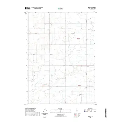
2020 Map of Burley NE
USGS Topo · Published 2020About this map
Agricultural irrigation systems define the landscape of this Minidoka County region, where a complex network of man-made waterways supports the local farm economy. The engineering of the high desert is visible in the paths of the C-2 Canal and C-1 Canal, alongside several major drainage features including the K Main Drain and H Main Drain. These systems represent decades of water management essential for transforming the arid Snake River Plain into productive farmland.
Find a feature on this map
23 named features on this map. Tap any name to fly to it.
Don’t see what you’re looking for? This feature index may not catch every label — zoom into the map to look around manually.
Map Details
Editions of this 2020 Burley NE Map
This is the sole edition of this map. No revisions or reprints were ever made.
Other maps of this area

1954 · Pocatello
USGS Topo · 1:250,000

1958 · Pocatello
USGS Topo · 1:250,000

1964 · Burley SW
USGS Topo · 1:24,000

1964 · Burley NE
USGS Topo · 1:24,000

1964 · Rupert NW
USGS Topo · 1:24,000

1964 · Burley NW
USGS Topo · 1:24,000

1964 · Rupert SW
USGS Topo · 1:24,000

1964 · Burley SE
USGS Topo · 1:24,000

1972 · Kimama
USGS Topo · 1:24,000
1972 · Kimama Butte
USGS Topo · 1:24,000