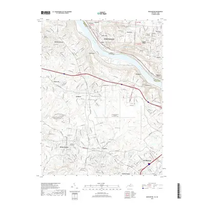
2019 Map of Burlington
USGS Topo · Published 2019About this map
The Ohio River carves a deep valley between Hamilton and Boone Counties, separating the riverfront communities of Addyston, Fernbank, and Sayler Park from the Kentucky shore. This 2019 survey documents the extensive grounds of the Cincinnati/Northern Kentucky International Airport, which dominates the central Kentucky plateau south of Hebron. For genealogists, the map is remarkably dense with burial sites and family landmarks, ranging from the Colonial Abraham Depew Grave in the northwest to the Mount Saint Joseph Cem near Delhi. The landscape transitions from the urbanized sprawl of Florence and Burlington to the steep, wooded ravines of Elijahs Creek and Gunpowder Creek. Notable transit points like Anderson Ferry and the older centers of Constance and Taylorsport illustrate the long-standing cross-river connectivity essential to the Cincinnati metropolitan area.
Find a feature on this map
239 named features on this map. Tap any name to fly to it.
Don’t see what you’re looking for? This feature index may not catch every label — zoom into the map to look around manually.
Map Details
Editions of this 2019 Burlington Map
This is the sole edition of this map. No revisions or reprints were ever made.
Other maps of this area

1914 · West Cincinnati
USGS Topo · 1:62,500

1915 · Lawrenceburg
USGS Topo · 1:48,000

1928 · Lawrenceburg
USGS Topo · 1:62,500

1932 · Lawrenceburg
USGS Topo · 1:62,500

1943 · Rising Sun
USGS Topo · 1:24,000

1943 · Hooven
USGS Topo · 1:24,000

1943 · Lawrenceburg
USGS Topo · 1:24,000

1950 · Union
USGS Topo · 1:24,000

1950 · Independence
USGS Topo · 1:24,000

1950 · Covington
USGS Topo · 1:24,000