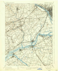
1906 Map of Burlington
USGS Topo · Published 1936About this map
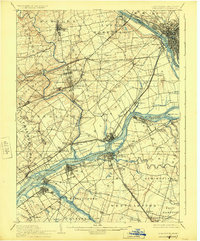
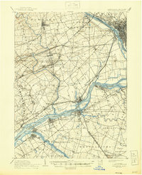
The Delaware River serves as the central artery for this early twentieth-century landscape, dividing the riverfront industrial and transport hubs of Bucks County from those in New Jersey. The extensive reach of the Delaware Division Pennsylvania Canal runs parallel to the river, illustrating the persistent importance of waterborne transport alongside a burgeoning rail network. Major junctions like Langhorne and Newtown anchor the interior, while the riverbanks are dotted with specialized infrastructure such as Tullytown Wharf and Andalusia Wharf. The presence of the State Lunatic Asylum near Asylum Station and the George School further north highlights the varied institutional and educational character of the region. Numerous railroads, including the Phila and Newtown RR and the Trenton Cut-Off RR, crisscross the territory, connecting established settlements like Morrisville, Yardley, and Fallsington to the larger regional economy.
Find a feature on this map
126 named features on this map. Tap any name to fly to it.
Don’t see what you’re looking for? This feature index may not catch every label — zoom into the map to look around manually.
Map Details
Editions of this 1906 Burlington Map
6 editions found
Other maps of this area

1888 · Bordentown
USGS Topo · 1:62,500

1888 · Pemberton
USGS Topo · 1:62,500

1888 · Mount Holly
USGS Topo · 1:62,500

1888 · Princeton
USGS Topo · 1:62,500

1890 · Lambertville
USGS Topo · 1:62,500

1890 · Doylestown
USGS Topo · 1:62,500

1890 · Burlington
USGS Topo · 1:62,500

1891 · Lambertville
USGS Topo · 1:62,500

1891 · Doylestown
USGS Topo · 1:62,500

1891 · Philadelphia
USGS Topo · 1:62,500