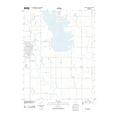
2009 Map of Burlington
USGS Topo · Published 2009About this map
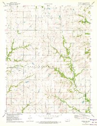
Burlington serves as the focal point of this Coffey County survey, situated along the meandering path of the Neosho River. The landscape is defined by the massive expanse of the Wolf Creek Reservoir to the northeast, which dominates the local hydrology and redirected the historic flow of Wolf Creek. In town, a structured grid of streets including Kennebec St and Housatonic St gives way to the more rural sections of the county. Several established burial grounds, such as Mount Hope Cemetery and Graceland Cemetery, provide valuable anchor points for genealogical research. The surrounding countryside is marked by a network of drainage systems like Rock Creek and Covey Run, alongside prominent local landmarks such as Jackrabbit Hill and Mathias Lake, reflecting a region deeply tied to its water resources and agricultural land divisions.
Find a feature on this map
54 named features on this map. Tap any name to fly to it.
Don’t see what you’re looking for? This feature index may not catch every label — zoom into the map to look around manually.
Map Details
Editions of this 2009 Burlington Map
This is the sole edition of this map. No revisions or reprints were ever made.
Other maps of this area

1885 · Burlington
USGS Topo · 1:125,000

1894 · Burlington
USGS Topo · 1:125,000

1947 · Lawrence
USGS Topo · 1:250,000

1950 · Lawrence
USGS Topo · 1:250,000

1956 · Lawrence
USGS Topo · 1:250,000

1961 · Lawrence
USGS Topo · 1:250,000
1966 · John Redmond Dam
USGS Topo · 1:24,000
1967 · Gridley SE
USGS Topo · 1:24,000
1970 · Ottumwa
USGS Topo · 1:24,000
1971 · Waverly SE
USGS Topo · 1:24,000