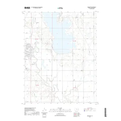
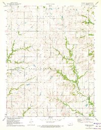
2018 Map of Burlington
USGS Topo · Published 2018About this map
The Neosho River winds through the heart of Burlington, anchoring a landscape where riparian geography meets established township grids. This modern survey reflects the enduring structure of Coffey County, showing the intricate network of residential streets such as Niagara St and Alleghany St that define the town center. Local history and genealogy are preserved in the numerous cemeteries scattered throughout the quadrangle, including Mount Hope Cem and Graceland Cem near the river, and more isolated locations like Sherwood Cem further east. Outside the settlement, the terrain rises toward Jackrabbit Hill while several tributaries, including Wolf Cr and Long Cr, drain into the primary river valley. The map documents the persistent layout of rural road networks and township boundaries like t21s r15e, illustrating how the agricultural and civic landscape has matured into the 21st century.
Find a feature on this map
79 named features on this map. Tap any name to fly to it.
Don’t see what you’re looking for? This feature index may not catch every label — zoom into the map to look around manually.
Map Details
Editions of this 2018 Burlington Map
This is the sole edition of this map. No revisions or reprints were ever made.
Other maps of this area

1885 · Burlington
USGS Topo · 1:125,000

1894 · Burlington
USGS Topo · 1:125,000

1947 · Lawrence
USGS Topo · 1:250,000

1950 · Lawrence
USGS Topo · 1:250,000

1956 · Lawrence
USGS Topo · 1:250,000

1961 · Lawrence
USGS Topo · 1:250,000
1966 · John Redmond Dam
USGS Topo · 1:24,000
1967 · Gridley SE
USGS Topo · 1:24,000
1970 · Ottumwa
USGS Topo · 1:24,000
1971 · Waverly SE
USGS Topo · 1:24,000