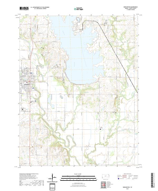
2022 Map of Burlington
USGS Topo · Published 2022About this map
Burlington serves as the focal point of this Coffey County landscape, where the Neosho River and Wolf Creek converge. The town grid is clearly defined, anchored by the Coffey County Courthouse and a series of residential streets like Kennebec St and Martindale St. To the south and west of the main settlement, several historic burial grounds are preserved, including Mount Hope Cem and Graceland Cem, providing valuable touchstones for genealogical research in the river valley.
Find a feature on this map
48 named features on this map. Tap any name to fly to it.
Don’t see what you’re looking for? This feature index may not catch every label — zoom into the map to look around manually.
Map Details
Editions of this 2022 Burlington Map
This is the sole edition of this map. No revisions or reprints were ever made.
Other maps of this area

1885 · Burlington
USGS Topo · 1:125,000

1894 · Burlington
USGS Topo · 1:125,000

1947 · Lawrence
USGS Topo · 1:250,000

1950 · Lawrence
USGS Topo · 1:250,000

1956 · Lawrence
USGS Topo · 1:250,000

1961 · Lawrence
USGS Topo · 1:250,000
1966 · John Redmond Dam
USGS Topo · 1:24,000
1967 · Gridley SE
USGS Topo · 1:24,000
1970 · Ottumwa
USGS Topo · 1:24,000
1971 · Waverly SE
USGS Topo · 1:24,000