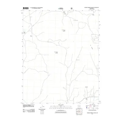
2011 Map of Burned Timber Canyon
USGS Topo · Published 2011About this map
Zuni Indian Tribal Lands and Ramah Indian Tribal Lands define the administrative and cultural landscape of this high-elevation New Mexico territory. The region is marked by significant topographical shifts, most notably The Hogback and the twin peaks of North Burned Timber Mountain and South Burned Timber Mountain. Water sources such as the Rio Nutria in the northwest and Rio Pescado in the southwest have historically influenced land use and movement through this arid environment.
Find a feature on this map
25 named features on this map. Tap any name to fly to it.
Don’t see what you’re looking for? This feature index may not catch every label — zoom into the map to look around manually.
Map Details
Editions of this 2011 Burned Timber Canyon Map
This is the sole edition of this map. No revisions or reprints were ever made.
Other maps of this area

1886 · Wingate
USGS Topo · 1:250,000

1892 · Wingate
USGS Topo · 1:250,000

1954 · Gallup
USGS Topo · 1:250,000

1958 · Gallup
USGS Topo · 1:250,000

1959 · Gallup
USGS Topo · 1:250,000

1962 · Gallup
USGS Topo · 1:250,000

1962 · Page
USGS Topo · 1:24,000
1963 · Togeye Lake
USGS Topo · 1:24,000
1963 · Ramah
USGS Topo · 1:24,000

1963 · Pinehaven
USGS Topo · 1:24,000