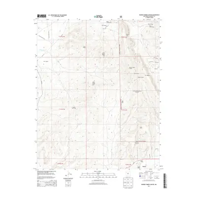
2013 Map of Burned Timber Canyon
USGS Topo · Published 2013About this map
Zuni Indian Tribal Lands and Ramah Indian Tribal Lands define the high-desert landscape of this region in McKinley County. The terrain is marked by significant elevation changes, ranging from the heights of North Burned Timber Mtn and South Burned Timber Mtn to the deep incisions of Burned Timber Canyon and Box S Canyon. Water management is central to the area's geography, evidenced by the Nutria Reservoir Number 3 and the seasonal courses of Rio Nutria and Cebolla Cr.
Find a feature on this map
39 named features on this map. Tap any name to fly to it.
Don’t see what you’re looking for? This feature index may not catch every label — zoom into the map to look around manually.
Map Details
Editions of this 2013 Burned Timber Canyon Map
This is the sole edition of this map. No revisions or reprints were ever made.
Other maps of this area

1886 · Wingate
USGS Topo · 1:250,000

1892 · Wingate
USGS Topo · 1:250,000

1954 · Gallup
USGS Topo · 1:250,000

1958 · Gallup
USGS Topo · 1:250,000

1959 · Gallup
USGS Topo · 1:250,000

1962 · Gallup
USGS Topo · 1:250,000

1962 · Page
USGS Topo · 1:24,000
1963 · Togeye Lake
USGS Topo · 1:24,000
1963 · Ramah
USGS Topo · 1:24,000

1963 · Pinehaven
USGS Topo · 1:24,000