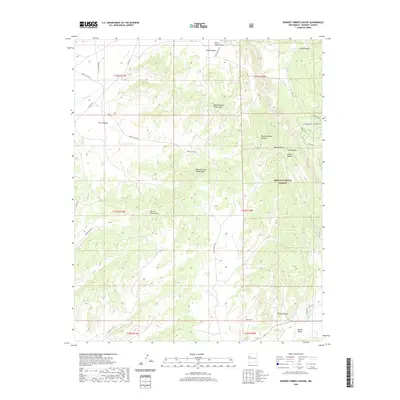
2020 Map of Burned Timber Canyon
USGS Topo · Published 2020About this map
Cibola National Forest defines the high-desert landscape of this region in McKinley County, where prominent elevations like North Burned Timber Mtn and South Burned Timber Mtn overlook a complex system of drainages. The topography is dominated by deep seasonal watercourses and ridges, most notably The Hogback and the titular Burned Timber Canyon. These geological features influence the local road network, which includes several Indian Service Routes such as Indian Svc Rte 26 and Indian Svc Rte 12 that navigate the terrain.
Find a feature on this map
36 named features on this map. Tap any name to fly to it.
Don’t see what you’re looking for? This feature index may not catch every label — zoom into the map to look around manually.
Map Details
Editions of this 2020 Burned Timber Canyon Map
This is the sole edition of this map. No revisions or reprints were ever made.
Other maps of this area

1886 · Wingate
USGS Topo · 1:250,000

1892 · Wingate
USGS Topo · 1:250,000

1954 · Gallup
USGS Topo · 1:250,000

1958 · Gallup
USGS Topo · 1:250,000

1959 · Gallup
USGS Topo · 1:250,000

1962 · Gallup
USGS Topo · 1:250,000

1962 · Page
USGS Topo · 1:24,000
1963 · Togeye Lake
USGS Topo · 1:24,000
1963 · Ramah
USGS Topo · 1:24,000

1963 · Pinehaven
USGS Topo · 1:24,000