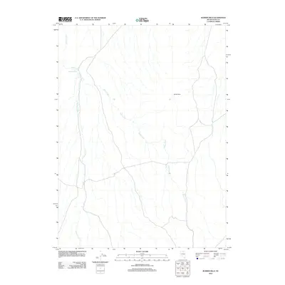
2012 Map of Burner Hills
USGS Topo · Published 2012About this map
Burner Hills define this high-desert landscape in northern Elko County, where seasonal drainage patterns and isolated water sources dictate the geography. The terrain is dominated by the complex network of Willow Creek, which weaves through the center of the quadrangle, and Milligan Creek to the west. This 2012 survey by the U.S. Geological Survey provides a precise accounting of these water resources, including the specifically named Bookkeeper Spring near the northwestern corner. The map reflects a characteristically open ranching or grazing territory, marked primarily by its hydrography and topographical relief rather than dense human settlement or industrial development.
Find a feature on this map
4 named features on this map. Tap any name to fly to it.
Don’t see what you’re looking for? This feature index may not catch every label — zoom into the map to look around manually.
Map Details
Editions of this 2012 Burner Hills Map
This is the sole edition of this map. No revisions or reprints were ever made.
Other maps of this area

1955 · McDermitt
USGS Topo · 1:250,000

1959 · McDermitt
USGS Topo · 1:250,000

1973 · McCleary Wells
USGS Topo · 1:24,000

1973 · Haystack Peak
USGS Topo · 1:24,000

1973 · Little Rock Creek
USGS Topo · 1:24,000

1974 · Soldier Cap
USGS Topo · 1:24,000

1974 · Middle Draw Reservoir
USGS Topo · 1:24,000

1974 · Winters Ranch Reservoir
USGS Topo · 1:24,000

1974 · Burner Hills
USGS Topo · 1:24,000

1977 · Scraper Springs
USGS Topo · 1:24,000