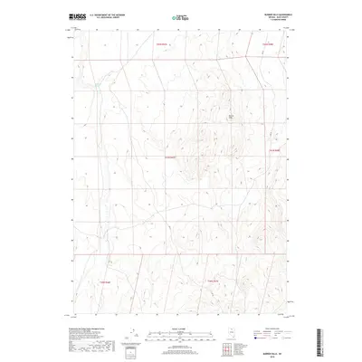
2018 Map of Burner Hills
USGS Topo · Published 2018About this map
Burner Hills dominates the interior of this Elko County landscape, where the topography rises to define a series of ridges and drainages. The area is marked by a sparse network of historical land divisions, including t41n r47e, which segments the high desert terrain. Water resources are rare in this environment, with Bookkeeper Spring providing a critical focal point in the northwest. Transportation is limited to a primary route, identified as Ssr 18, which skirts the eastern and southern edges of the hills, suggesting the movement of cattle or minerals through this portion of Nevada. This survey from the U.S. Geological Survey provides a precise view of the local topography before more recent developments, preserving the original nomenclature of the Great Basin land system.
Find a feature on this map
9 named features on this map. Tap any name to fly to it.
Don’t see what you’re looking for? This feature index may not catch every label — zoom into the map to look around manually.
Map Details
Editions of this 2018 Burner Hills Map
This is the sole edition of this map. No revisions or reprints were ever made.
Other maps of this area

1955 · McDermitt
USGS Topo · 1:250,000

1959 · McDermitt
USGS Topo · 1:250,000

1973 · McCleary Wells
USGS Topo · 1:24,000

1973 · Haystack Peak
USGS Topo · 1:24,000

1973 · Little Rock Creek
USGS Topo · 1:24,000

1974 · Soldier Cap
USGS Topo · 1:24,000

1974 · Middle Draw Reservoir
USGS Topo · 1:24,000

1974 · Winters Ranch Reservoir
USGS Topo · 1:24,000

1974 · Burner Hills
USGS Topo · 1:24,000

1977 · Scraper Springs
USGS Topo · 1:24,000