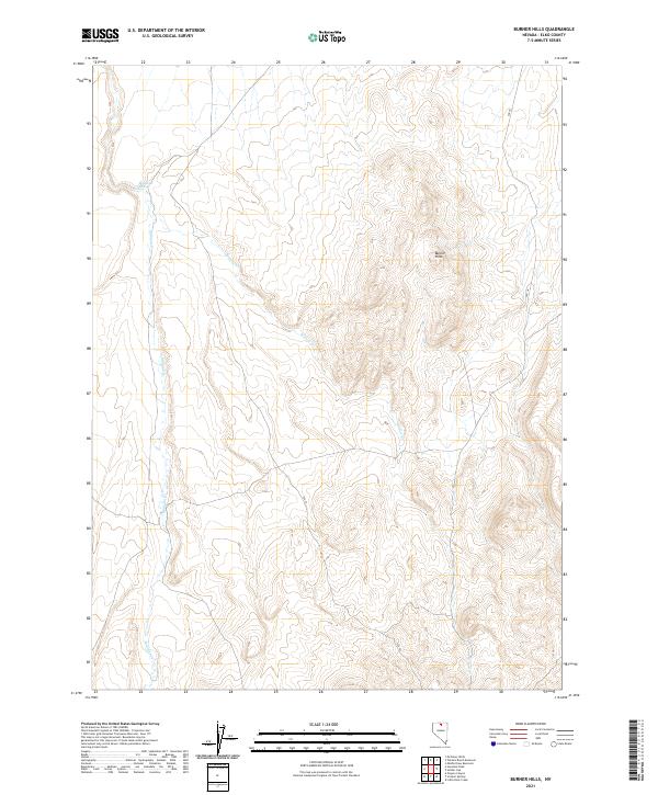
2021 Map of Burner Hills
USGS Topo · Published 2021About this map
The Burner Hills define the high ground of this remote Elko County landscape, where deep drainage patterns reveal the steady work of Milligan Cr and Willow Cr. Surveyed by the U.S. Geological Survey, the map highlights the intricate relationship between topography and the scarce water sources essential for survival in this arid region, such as Bookkeeper Spring. The terrain is marked by a rigorous public land survey system, including townships like t41n r47e, which partition the high desert for grazing and resource management. A single thoroughfare, SSR 18, provides the primary transit through the hills, tracing a path that avoids the most severe elevations while connecting the northern and southern reaches of the quadrangle. This 2021 study documents the contemporary character of a landscape that remains largely defined by its natural contours and seasonal waterways.
Find a feature on this map
11 named features on this map. Tap any name to fly to it.
Don’t see what you’re looking for? This feature index may not catch every label — zoom into the map to look around manually.
Map Details
Editions of this 2021 Burner Hills Map
This is the sole edition of this map. No revisions or reprints were ever made.
Other maps of this area

1955 · McDermitt
USGS Topo · 1:250,000

1959 · McDermitt
USGS Topo · 1:250,000

1973 · McCleary Wells
USGS Topo · 1:24,000

1973 · Haystack Peak
USGS Topo · 1:24,000

1973 · Little Rock Creek
USGS Topo · 1:24,000

1974 · Soldier Cap
USGS Topo · 1:24,000

1974 · Middle Draw Reservoir
USGS Topo · 1:24,000

1974 · Winters Ranch Reservoir
USGS Topo · 1:24,000

1974 · Burner Hills
USGS Topo · 1:24,000

1977 · Scraper Springs
USGS Topo · 1:24,000