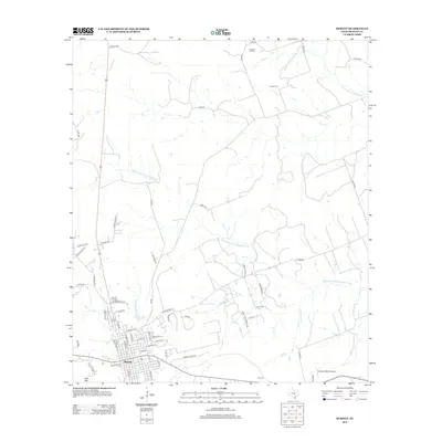
2012 Map of Burnet
USGS Topo · Published 2012About this map
The city of Burnet serves as the focal point of this 2012 survey, situated amidst the complex drainage patterns of the Russell Fork San Gabriel River and Hamilton Cr. The landscape is defined by its transition from urban residential blocks to ranching properties, with Post Mtn providing a significant topographical landmark southwest of the city center. This edition captures the expansion of local road networks like Summit Ridge RD and Shady Grove RD that have connected once-isolated farmsteads to the central hub. Local history and genealogy interest is concentrated at Pleasant Hill Cem and Bethel Cem to the north, while the small settlement of Summit and the Deiterich Ranch Airport mark the southern reaches. Numerous small tributaries, including Haynie Br and Robinson Br, carve through the terrain, illustrating the hydrological significance of this portion of Burnet County.
Find a feature on this map
66 named features on this map. Tap any name to fly to it.
Don’t see what you’re looking for? This feature index may not catch every label — zoom into the map to look around manually.
Map Details
Editions of this 2012 Burnet Map
This is the sole edition of this map. No revisions or reprints were ever made.
Other maps of this area

1887 · Burnet
USGS Topo · 1:125,000

1893 · Burnet
USGS Topo · 1:125,000

1903 · Burnet
USGS Topo · 1:125,000

1909 · Burnet
USGS Topo · 1:125,000

1929 · Marble Falls
USGS Topo · 1:62,500

1932 · Tow
USGS Topo · 1:62,500

1932 · Marble Falls
USGS Topo · 1:62,500

1932 · Bertram
USGS Topo · 1:62,500

1954 · Llano
USGS Topo · 1:250,000

1955 · Llano
USGS Topo · 1:250,000