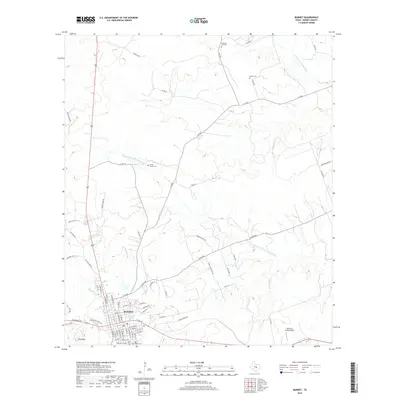
2019 Map of Burnet
USGS Topo · Published 2019About this map
Burnet serves as the focal point of this Central Texas landscape, situated where several significant watercourses converge. The town's layout is defined by its proximity to Hamilton Cr and Haynie Br, with the residential and commercial grid stretching north toward the broader Texas Hill Country. For those researching local heritage, the map identifies a high concentration of burial sites, including the Old Burnet Cem, Odd Fellows Cem, and the Frazier Family Cem.
Find a feature on this map
71 named features on this map. Tap any name to fly to it.
Don’t see what you’re looking for? This feature index may not catch every label — zoom into the map to look around manually.
Map Details
Editions of this 2019 Burnet Map
This is the sole edition of this map. No revisions or reprints were ever made.
Other maps of this area

1887 · Burnet
USGS Topo · 1:125,000

1893 · Burnet
USGS Topo · 1:125,000

1903 · Burnet
USGS Topo · 1:125,000

1909 · Burnet
USGS Topo · 1:125,000

1929 · Marble Falls
USGS Topo · 1:62,500

1932 · Tow
USGS Topo · 1:62,500

1932 · Marble Falls
USGS Topo · 1:62,500

1932 · Bertram
USGS Topo · 1:62,500

1954 · Llano
USGS Topo · 1:250,000

1955 · Llano
USGS Topo · 1:250,000