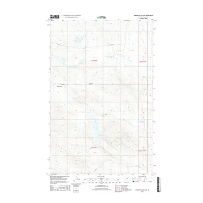
2017 Map of Burnett Flats East
USGS Topo · Published 2017About this map
Burnett Flats dominates this section of Valley County, where the dry landscape of eastern Montana is punctuated by man-made water storage and seasonal drainage patterns. The ranching and industrial infrastructure is evident through a series of reservoirs, including Hamms Reservoir, Moccasin Reservoir, Hurricane Reservoir, and Arrambide Reservoir. These catchments, along with smaller features like Jini Reservoir, suggest a reliance on managed water resources in a region carved by the Arrambide Coulee and the headwaters of Little Beaver Cr.
Find a feature on this map
19 named features on this map. Tap any name to fly to it.
Don’t see what you’re looking for? This feature index may not catch every label — zoom into the map to look around manually.
Map Details
Editions of this 2017 Burnett Flats East Map
This is the sole edition of this map. No revisions or reprints were ever made.
Other maps of this area

1943 · Glasgow
USGS Topo · 1:125,000

1954 · Jordan
USGS Topo · 1:250,000

1954 · Glasgow
USGS Topo · 1:250,000

1956 · Jordan
USGS Topo · 1:250,000

1957 · Glasgow
USGS Topo · 1:250,000

1958 · Glasgow
USGS Topo · 1:250,000

1958 · Jordan
USGS Topo · 1:250,000

1958 · Miller Coulee
USGS Topo · 1:62,500

1958 · Collins Ranch
USGS Topo · 1:62,500
1958 · Billick Coulee
USGS Topo · 1:24,000