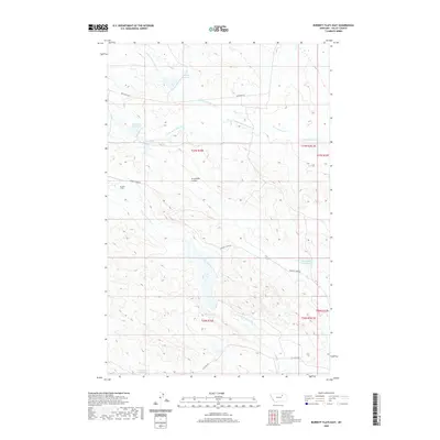
2020 Map of Burnett Flats East
USGS Topo · Published 2020About this map
Burnett Flats dominates this portion of Valley County, where the high plains are carved by an intricate network of drainage systems and man-made water improvements. The landscape is defined by the headwaters of N Fork Little Beaver Cr and the N Fork Lone Tree Creek, which wind through the township boundaries. Local ranchers and land managers have established a series of vital water sources across the terrain, including Hamms Reservoir, Moccasin Reservoir, and Arrambide Reservoir. These catchments, often named for local figures or landmarks like Arrambide Coulee, illustrate the essential infrastructure required for life and agriculture in this arid region. Remote access is provided by a handful of dirt routes such as Bentonite Rd and Burnett Spur Rd, tracing the high ground between the coulees.
Find a feature on this map
23 named features on this map. Tap any name to fly to it.
Don’t see what you’re looking for? This feature index may not catch every label — zoom into the map to look around manually.
Map Details
Editions of this 2020 Burnett Flats East Map
This is the sole edition of this map. No revisions or reprints were ever made.
Other maps of this area

1943 · Glasgow
USGS Topo · 1:125,000

1954 · Jordan
USGS Topo · 1:250,000

1954 · Glasgow
USGS Topo · 1:250,000

1956 · Jordan
USGS Topo · 1:250,000

1957 · Glasgow
USGS Topo · 1:250,000

1958 · Glasgow
USGS Topo · 1:250,000

1958 · Jordan
USGS Topo · 1:250,000

1958 · Miller Coulee
USGS Topo · 1:62,500

1958 · Collins Ranch
USGS Topo · 1:62,500
1958 · Billick Coulee
USGS Topo · 1:24,000