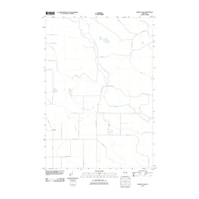
2010 Map of Burney Lake
USGS Topo · Published 2010About this map
The settlement of Almon sits at the southwestern edge of this landscape, where the local road network begins to branch into the dense hydrography of central Wisconsin. The area is defined by the converging paths of the Red River, West Branch Red River, and Little West Branch Wolf River, creating a complex drainage system that heavily influenced the placement of early routes. Several roads bear names that suggest the historic land use of the region, such as McCall Camp Rd, National Guard Rd, and Wagon Bridge Rd. The grid of section lines is occasionally interrupted by more organic paths like Stoney Curve Rd and Mohheconnuck Rd, reflecting the area's transition from early timber and agricultural access to more modern recreational and residential use near the many creeks and river forks.
Find a feature on this map
30 named features on this map. Tap any name to fly to it.
Don’t see what you’re looking for? This feature index may not catch every label — zoom into the map to look around manually.
Map Details
Editions of this 2010 Burney Lake Map
This is the sole edition of this map. No revisions or reprints were ever made.
Other maps of this area

1952 · Antigo
USGS Topo · 1:48,000

1952 · White Lake
USGS Topo · 1:48,000

1954 · Wittenberg
USGS Topo · 1:48,000

1954 · Gresham
USGS Topo · 1:48,000

1954 · Iron Mountain
USGS Topo · 1:250,000

1955 · Green Bay
USGS Topo · 1:250,000

1959 · Iron Mountain
USGS Topo · 1:250,000

1964 · Wittenberg
USGS Topo · 1:62,500

1964 · Gresham
USGS Topo · 1:62,500
1973 · Mattoon
USGS Topo · 1:24,000