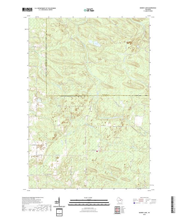
2022 Map of Burney Lake
USGS Topo · Published 2022About this map
Burney Lake and the winding course of the Red River anchor this landscape along the border of Shawano and Menominee counties. The area is defined by a complex network of waterways, including the Little W Br Wolf River and Miller Cr, set within a predominantly rural and forested terrain. The local road system, marked by Bureau of Indian Affairs routes like Bia Rte 118 and Bia Rte 159, suggests a geography shaped by tribal land management and forestry.
Find a feature on this map
43 named features on this map. Tap any name to fly to it.
Don’t see what you’re looking for? This feature index may not catch every label — zoom into the map to look around manually.
Map Details
Editions of this 2022 Burney Lake Map
This is the sole edition of this map. No revisions or reprints were ever made.
Other maps of this area

1952 · Antigo
USGS Topo · 1:48,000

1952 · White Lake
USGS Topo · 1:48,000

1954 · Wittenberg
USGS Topo · 1:48,000

1954 · Gresham
USGS Topo · 1:48,000

1954 · Iron Mountain
USGS Topo · 1:250,000

1955 · Green Bay
USGS Topo · 1:250,000

1959 · Iron Mountain
USGS Topo · 1:250,000

1964 · Wittenberg
USGS Topo · 1:62,500

1964 · Gresham
USGS Topo · 1:62,500
1973 · Mattoon
USGS Topo · 1:24,000