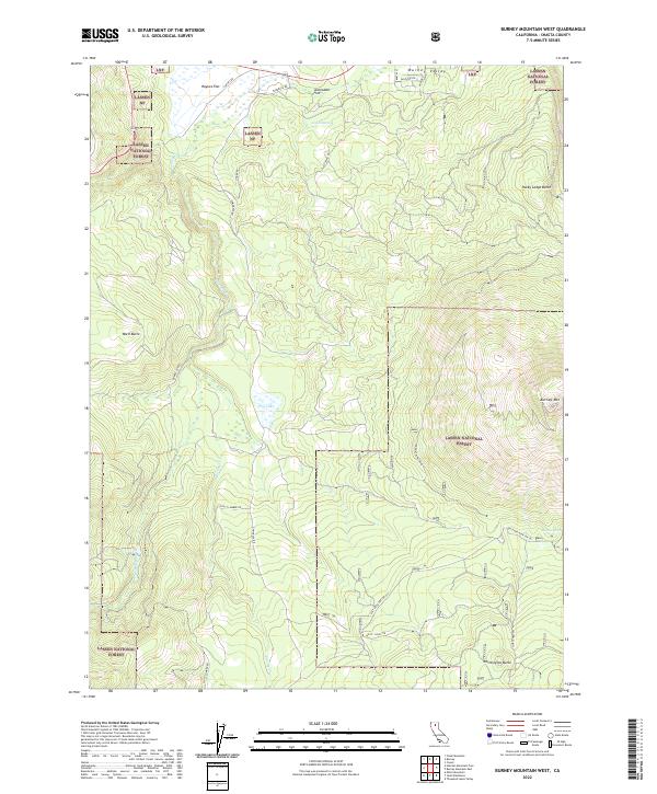
2022 Map of Burney Mountain West
USGS Topo · Published 2022About this map
Burney Mtn anchors this section of the Lassen National Forest in Shasta County, showing a landscape defined by volcanic peaks and high-elevation flats. The northern reaches transition into Burney Valley, where the terrain levels out at Haynes Flat and Jackrabbit Flat. This 2022 survey details a complex network of forestry and access roads, including Cinder Rd and Tamarack Rd, which service the timberlands and provide passage through the townships of t34n r2e and t35n r3e. Water sources are vital markers in this environment, from the perennial flow of Burney Creek and its tributary Greens Burney Cr to isolated points like Indian Spring and Dry Lake. Significant landmarks for navigation and observation include the Burney Mtn Lookout and several prominent volcanic formations such as Whittington Butte and Rocky Ledge Butte.
Find a feature on this map
33 named features on this map. Tap any name to fly to it.
Don’t see what you’re looking for? This feature index may not catch every label — zoom into the map to look around manually.
Map Details
Editions of this 2022 Burney Mountain West Map
This is the sole edition of this map. No revisions or reprints were ever made.
Other maps of this area

1886 · Lassen Peak
USGS Topo · 1:250,000

1892 · Lassen Peak
USGS Topo · 1:250,000

1894 · Lassen Peak
USGS Topo · 1:250,000

1935 · Burney
USGS Topo · 1:96,000

1939 · Burney
USGS Topo · 1:125,000

1955 · Westwood
USGS Topo · 1:250,000

1956 · Manzanita Lake
USGS Topo · 1:62,500
1956 · Whitmore
USGS Topo · 1:62,500
1956 · Montgomery Creek
USGS Topo · 1:62,500

1957 · Burney
USGS Topo · 1:62,500