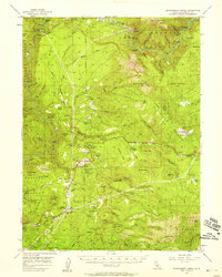
1956 Map of Montgomery Creek
USGS Topo · Published 1958About this map
Montgomery Creek Indian Rancheria and Roaring Creek Indian Rancheria ground this mid-century survey of the Cascade foothills in eastern Shasta County. The landscape is defined by the steep canyons of the Pit River, where industrial development is evident at the Pit No 5 Powerhouse and Pit No 4 Dam. These hydroelectric facilities represent a significant era of infrastructure expansion along the river's volcanic reach, powering distant urban centers while reshaping the local terrain.
Find a feature on this map
117 named features on this map. Tap any name to fly to it.
Don’t see what you’re looking for? This feature index may not catch every label — zoom into the map to look around manually.
Map Details
Editions of this 1956 Montgomery Creek Map
3 editions found
Other maps of this area

1886 · Lassen Peak
USGS Topo · 1:250,000

1886 · Modoc Lava Bed
USGS Topo · 1:250,000

1886 · Shasta
USGS Topo · 1:250,000

1890 · Red Bluff
USGS Topo · 1:250,000

1892 · Modoc Lava-Bed
USGS Topo · 1:250,000

1892 · Lassen Peak
USGS Topo · 1:250,000

1894 · Lassen Peak
USGS Topo · 1:250,000

1894 · Red Bluff
USGS Topo · 1:250,000

1894 · Shasta
USGS Topo · 1:250,000

1901 · Redding
USGS Topo · 1:125,000