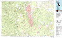
1976 Map of Burney
USGS Topo · Published 1992About this map
The Pit River and its northern tributaries define the rugged geography of this Northern California survey, which includes the convergence of the Shasta, Lassen, and Modoc National Forest lands. The settlement at Burney serves as a central hub for the region, while smaller communities like Whitmore, Inwood, and Viola occupy the western slopes. Large sections of wilderness are preserved here, notably the Thousand Lakes Wilderness and portions of Lassen Volcanic National Park, characterized by volcanic features such as Prospect Peak and Black Butte.
Find a feature on this map
46 named features on this map. Tap any name to fly to it.
Don’t see what you’re looking for? This feature index may not catch every label — zoom into the map to look around manually.
Map Details
Editions of this 1976 Burney Map
3 editions found
Other maps of this area

1886 · Alturas
USGS Topo · 1:250,000

1886 · Honey Lake
USGS Topo · 1:250,000

1886 · Lassen Peak
USGS Topo · 1:250,000

1886 · Modoc Lava Bed
USGS Topo · 1:250,000

1886 · Shasta
USGS Topo · 1:250,000

1890 · Red Bluff
USGS Topo · 1:250,000

1891 · Honey Lake
USGS Topo · 1:250,000

1892 · Modoc Lava-Bed
USGS Topo · 1:250,000

1892 · Lassen Peak
USGS Topo · 1:250,000

1892 · Alturas
USGS Topo · 1:250,000