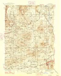
1939 Map of Burney
USGS Topo · Published 1947About this map
The Pit River winds through the northern reaches of this Shasta County landscape, powering early infrastructure with several Power Plants along its course. This 1930s era topography, surveyed by E.P. Davis and others, documents a rural economy defined by family ranching and timber. Significant holdings such as Black Ranch, Scharsch Ranch, and Farnsworth Ranch are scattered across the valley floors, while the southern boundary marks the early footprint of Lassen Volcanic National Park.
Find a feature on this map
194 named features on this map. Tap any name to fly to it.
Don’t see what you’re looking for? This feature index may not catch every label — zoom into the map to look around manually.
Map Details
Editions of this 1939 Burney Map
3 editions found

Other maps of this area

1886 · Lassen Peak
USGS Topo · 1:250,000

1886 · Modoc Lava Bed
USGS Topo · 1:250,000

1886 · Shasta
USGS Topo · 1:250,000

1890 · Red Bluff
USGS Topo · 1:250,000

1892 · Modoc Lava-Bed
USGS Topo · 1:250,000

1892 · Lassen Peak
USGS Topo · 1:250,000

1894 · Lassen Peak
USGS Topo · 1:250,000

1894 · Red Bluff
USGS Topo · 1:250,000

1894 · Shasta
USGS Topo · 1:250,000

1901 · Redding
USGS Topo · 1:125,000