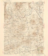
1939 Map of Burney
USGS Topo · Published 1939About this map
The Pit River and its major northern tributaries dominate this Shasta County landscape, where the volcanic topography of the southern Cascades meets the logging and ranching economies of the late 1930s. The settlement at Burney sits at a crossroads of the regional Highway system, while the Red River Lumber Co rail line snakes through the northeastern corner near Cassel and Lake Britton, marking the industrial footprint of the timber era.
Find a feature on this map
173 named features on this map. Tap any name to fly to it.
Don’t see what you’re looking for? This feature index may not catch every label — zoom into the map to look around manually.
Map Details
Editions of this 1939 Burney Map
3 editions found

Other maps of this area

1886 · Lassen Peak
USGS Topo · 1:250,000

1886 · Modoc Lava Bed
USGS Topo · 1:250,000

1886 · Shasta
USGS Topo · 1:250,000

1890 · Red Bluff
USGS Topo · 1:250,000

1892 · Modoc Lava-Bed
USGS Topo · 1:250,000

1892 · Lassen Peak
USGS Topo · 1:250,000

1894 · Lassen Peak
USGS Topo · 1:250,000

1894 · Red Bluff
USGS Topo · 1:250,000

1894 · Shasta
USGS Topo · 1:250,000

1901 · Redding
USGS Topo · 1:125,000