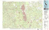
1976 Map of Burney
USGS Topo · Published 1992About this map
The volcanic activity of the southern Cascades dominates this mid-1970s landscape, most notably around the looming presence of Lassen Peak. Large lava flows and distinct formations like Cinder Cone and Chaos Crags are mapped in detail alongside geothermal and geological landmarks such as Lava Tube Cave. This region is a confluence of major protected lands, including the Shasta National Forest, Lassen National Forest, and the northern reaches of Lassen Volcanic National Park.
Find a feature on this map
61 named features on this map. Tap any name to fly to it.
Don’t see what you’re looking for? This feature index may not catch every label — zoom into the map to look around manually.
Map Details
Editions of this 1976 Burney Map
3 editions found
Other maps of this area

1886 · Alturas
USGS Topo · 1:250,000

1886 · Honey Lake
USGS Topo · 1:250,000

1886 · Lassen Peak
USGS Topo · 1:250,000

1886 · Modoc Lava Bed
USGS Topo · 1:250,000

1886 · Shasta
USGS Topo · 1:250,000

1890 · Red Bluff
USGS Topo · 1:250,000

1891 · Honey Lake
USGS Topo · 1:250,000

1892 · Modoc Lava-Bed
USGS Topo · 1:250,000

1892 · Lassen Peak
USGS Topo · 1:250,000

1892 · Alturas
USGS Topo · 1:250,000