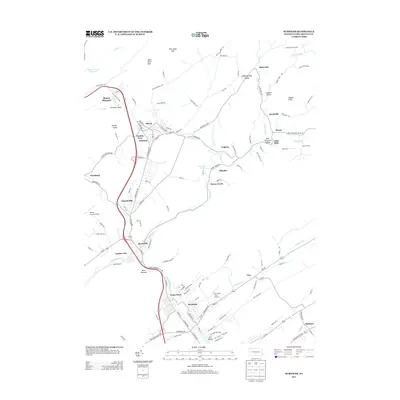
2013 Map of Burnham
USGS Topo · Published 2013About this map
Burnham and Yeagertown anchor the southern industrial corridor of this region, where the residential grid meets the banks of Kishacoquillas Creek. This 2013 survey illustrates a landscape of dense settlements tucked into the Kishacoquillas Valley, with the larger population centers connected by a developed road network that follows the natural contours of the valley floor. Aviation is well-represented in the area by both the Mifflin County Airport and the smaller Mc Cardle Farm Airport. Moving north, the map reveals a transition toward more dispersed communities such as Reedsville and Milroy. Notable natural landmarks include the Mammoth Spring and the narrow passage at Mann Narrows, while the northern reaches are defined by the Laurel Creek Reservoir and the distinctive topography of Will Johns Gap.
Find a feature on this map
128 named features on this map. Tap any name to fly to it.
Don’t see what you’re looking for? This feature index may not catch every label — zoom into the map to look around manually.
Map Details
Editions of this 2013 Burnham Map
This is the sole edition of this map. No revisions or reprints were ever made.
Other maps of this area

1924 · Centre Hall
USGS Topo · 1:62,500

1924 · Lewistown
USGS Topo · 1:62,500

1925 · Mifflintown
USGS Topo · 1:48,000

1927 · Lewisburg
USGS Topo · 1:62,500

1929 · Centre Hall
USGS Topo · 1:62,500

1934 · Mifflintown
USGS Topo · 1:62,500

1937 · Mifflintown
USGS Topo · 1:62,500

1937 · Millheim
USGS Topo · 1:48,000

1941 · Millheim
USGS Topo · 1:62,500

1943 · Lewistown
USGS Topo · 1:125,000
Featured Places
- Granville Township, PA
- Decatur Township, PA
- Burnham, PA
- Highland Park, Derry Township
- Milroy, Armagh Township