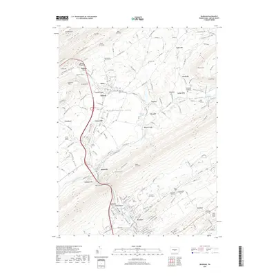
2019 Map of Burnham
USGS Topo · Published 2019About this map
Jacks Mountain and Long Mountain dominate this central Pennsylvania landscape, framing the fertile Kishacoquillas Valley where several historic townships and industrial hubs are located. The narrow passage of Mann Narrows serves as a critical geographic corridor, funneling Kishacoquillas Creek and major transportation routes like Old US Hwy 322 toward the denser settlements of Burnham and Yeagertown. The map reveals a high concentration of sites for local historians, including the Back Mountain Road Amish Cem and Vira Methodist Church.
Find a feature on this map
75 named features on this map. Tap any name to fly to it.
Don’t see what you’re looking for? This feature index may not catch every label — zoom into the map to look around manually.
Map Details
Editions of this 2019 Burnham Map
This is the sole edition of this map. No revisions or reprints were ever made.
Other maps of this area

1924 · Centre Hall
USGS Topo · 1:62,500

1924 · Lewistown
USGS Topo · 1:62,500

1925 · Mifflintown
USGS Topo · 1:48,000

1927 · Lewisburg
USGS Topo · 1:62,500

1929 · Centre Hall
USGS Topo · 1:62,500

1934 · Mifflintown
USGS Topo · 1:62,500

1937 · Mifflintown
USGS Topo · 1:62,500

1937 · Millheim
USGS Topo · 1:48,000

1941 · Millheim
USGS Topo · 1:62,500

1943 · Lewistown
USGS Topo · 1:125,000
Featured Places
- Granville Township, PA
- Decatur Township, PA
- Burnham, PA
- Highland Park, Derry Township
- Milroy, Armagh Township