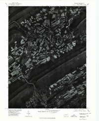
1977 Map of Burnham
USGS Topo · Published 1979About this map
Kishcoquillas anchors a landscape defined by sharp contrasts between intensive valley cultivation and the steep, wooded rise of Front Mountain. This 1977 orthophotoquad, produced by the Geological Survey in cooperation with the Soil Conservation Service, uses rectified aerial imagery to reveal the precise geometry of field patterns and drainage ways during the late 1970s. The meandering course of Honey Creek threads through the lowlands, its riparian corridor standing out against the patchwork of surrounding farms. Unlike a traditional topographic map, this photographic record provides a clear look at individual farmstead layouts, woodlots, and the reach of the forest edge against the valley floor, capturing the rural footprint of this portion of Mifflin County during a period of established agricultural use.
Find a feature on this map
4 named features on this map. Tap any name to fly to it.
Don’t see what you’re looking for? This feature index may not catch every label — zoom into the map to look around manually.
Map Details
Editions of this 1977 Burnham Map
This is the sole edition of this map. No revisions or reprints were ever made.
Other maps of this area

1924 · Centre Hall
USGS Topo · 1:62,500

1924 · Lewistown
USGS Topo · 1:62,500

1925 · Mifflintown
USGS Topo · 1:48,000

1927 · Lewisburg
USGS Topo · 1:62,500

1929 · Centre Hall
USGS Topo · 1:62,500

1934 · Mifflintown
USGS Topo · 1:62,500

1937 · Mifflintown
USGS Topo · 1:62,500

1937 · Millheim
USGS Topo · 1:48,000

1941 · Millheim
USGS Topo · 1:62,500

1943 · Lewistown
USGS Topo · 1:125,000
Featured Places
- Granville Township, PA
- Decatur Township, PA
- Burnham, PA
- Highland Park, Derry Township
- Milroy, Armagh Township