
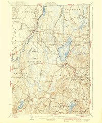
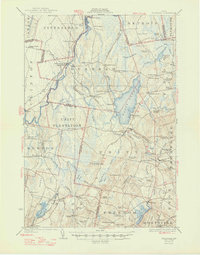
1926 Map of Burnham
USGS Topo · Published 1926About this map
The Sebasticook River and Twenty-fivemile Stream converge near the settlement of Burnham, defining a landscape of wetlands and winding waterways in the mid-1920s. This period of Maine's history is characterized by a dense network of district schools and rural post offices, such as the Carr School and Eelweir School to the north, and the Glidden School near Freedom. A distinct glacial feature known as The Horseback runs through the central terrain, while the Maine Central Railroad provides the primary industrial link, passing through the Burnham Junc Sta at the village center.
Find a feature on this map
95 named features on this map. Tap any name to fly to it.
Don’t see what you’re looking for? This feature index may not catch every label — zoom into the map to look around manually.
Map Details
Editions of this 1926 Burnham Map
3 editions found
Other maps of this area

1892 · Waterville
USGS Topo · 1:62,500

1893 · Vassalboro
USGS Topo · 1:62,500

1898 · Vassalboro
USGS Topo · 1:62,500

1913 · Skowhegan
USGS Topo · 1:62,500

1915 · Belfast
USGS Topo · 1:62,500

1916 · Liberty
USGS Topo · 1:62,500

1917 · Belfast
USGS Topo · 1:62,500

1930 · Pittsfield
USGS Topo · 1:48,000

1931 · Stetson
USGS Topo · 1:48,000

1932 · Brooks
USGS Topo · 1:62,500