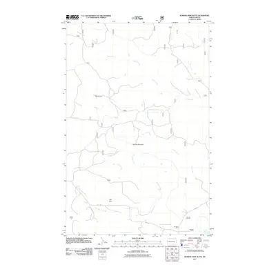
2011 Map of Burning Mine Butte
USGS Topo · Published 2011About this map
Burning Mine Butte stands as a central landmark in this portion of McKenzie County, rising above a landscape defined by an intricate network of drainages. The map details the convergence of various watercourses, including Burning Mine Creek, South Branch Bowline Creek, and Cedar Creek, which feed into the larger basins that eventually reach the Little Missouri River at the southeastern edge of the survey. The presence of Hayward Dam on the upper reaches of the South Branch Bowline Creek indicates the importance of water management for the ranching operations that dot the area.
Find a feature on this map
20 named features on this map. Tap any name to fly to it.
Don’t see what you’re looking for? This feature index may not catch every label — zoom into the map to look around manually.
Map Details
Editions of this 2011 Burning Mine Butte Map
This is the sole edition of this map. No revisions or reprints were ever made.
Other maps of this area

1953 · Watford City
USGS Topo · 1:250,000

1957 · Watford City
USGS Topo · 1:250,000

1967 · Watford City
USGS Topo · 1:250,000

1972 · Bear Butte
USGS Topo · 1:24,000

1972 · Moline School
USGS Topo · 1:24,000

1972 · Sheep Creek
USGS Topo · 1:24,000

1972 · Sather Lake
USGS Topo · 1:24,000
1972 · Burning Mine Butte
USGS Topo · 1:24,000
1974 · Ice Box Canyon
USGS Topo · 1:24,000
1974 · Cinnamon Creek
USGS Topo · 1:24,000