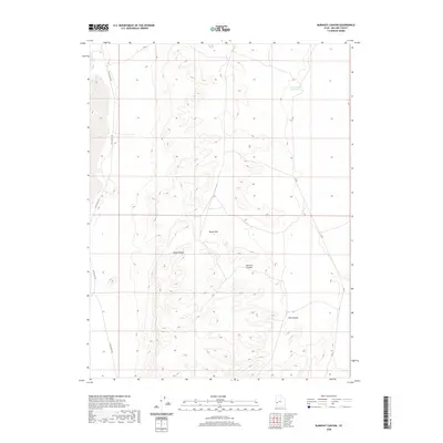
2020 Map of Burnout Canyon
USGS Topo · Published 2020About this map
The House Range dominates the western half of this Millard County landscape, where steep elevation changes define the transition from the high ridges down toward the desert floor. This 2020 topographic survey illustrates a land shaped by drainage and relief, with the namesake Burnout Canyon and neighboring Red Canyon cutting through the arid terrain. To the north, the Sevier Lake Reservoir provides a critical hydrological reference point in a region otherwise characterized by dry washes and sparse infrastructure. Transportation is limited to a few established corridors, primarily Tule Valley Rd skirting the western edge and Jc Rd to the east. These routes follow the natural contours of the basin, connecting the isolated Black Hills to the broader geological features of the Great Basin.
Find a feature on this map
7 named features on this map. Tap any name to fly to it.
Don’t see what you’re looking for? This feature index may not catch every label — zoom into the map to look around manually.
Map Details
Editions of this 2020 Burnout Canyon Map
This is the sole edition of this map. No revisions or reprints were ever made.
Other maps of this area

1908 · Fish Springs
USGS Topo · 1:250,000

1910 · Fish Springs
USGS Topo · 1:250,000

1953 · Richfield
USGS Topo · 1:250,000

1953 · Delta
USGS Topo · 1:250,000

1958 · Richfield
USGS Topo · 1:250,000

1958 · Delta
USGS Topo · 1:250,000

1960 · Notch Peak
USGS Topo · 1:62,500

1960 · The Barn
USGS Topo · 1:62,500

1962 · Delta
USGS Topo · 1:250,000
1972 · Needle Point
USGS Topo · 1:24,000