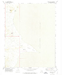
1972 Map of Needle Point
USGS Topo · Published 1974About this map
Sevier Lake dominates the eastern half of this Millard County landscape, where the ephemeral waters meet the arid salt flats of the Great Basin. The shoreline is punctuated by Needle Point, a prominent landform extending into the lake bed. This 1972 survey records a remote terrain managed through a series of catchment features, including Madsen Reservoir, Needle Reservoir, and the Needle Hardpan Reservoir. These water sources, critical for land management in such an arid environment, are connected by a sparse network of primitive transportation, most notably a Jeep Trail that skirts the Coyote Knolls to the northwest. The map provides an essential record of the hydraulic infrastructure and topography of the Sevier Desert before modern changes to the terminal lake system.
Find a feature on this map
12 named features on this map. Tap any name to fly to it.
Don’t see what you’re looking for? This feature index may not catch every label — zoom into the map to look around manually.
Map Details
Editions of this 1972 Needle Point Map
This is the sole edition of this map. No revisions or reprints were ever made.
Other maps of this area

1908 · Fish Springs
USGS Topo · 1:250,000

1910 · Fish Springs
USGS Topo · 1:250,000

1953 · Richfield
USGS Topo · 1:250,000

1953 · Delta
USGS Topo · 1:250,000

1958 · Richfield
USGS Topo · 1:250,000

1958 · Delta
USGS Topo · 1:250,000

1960 · Notch Peak
USGS Topo · 1:62,500

1960 · The Barn
USGS Topo · 1:62,500

1962 · Delta
USGS Topo · 1:250,000

1972 · Headlight Mtn
USGS Topo · 1:24,000