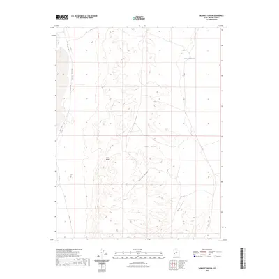
2023 Map of Burnout Canyon
USGS Topo · Published 2023About this map
The House Range dominates this portion of Millard County, creating a stark topographical divide between the expansive Tule Valley to the west and the high-elevation Black Hills to the east. Modern access is primarily defined by the Tule Valley Rd, which follows the base of the mountains, and the 3C Rd traversing the eastern plateau. The landscape is carved by significant drainage systems, including the namesake Burnout Canyon and Red Canyon, which flow eastward toward the Sevier Lake Reservoir. This 2023 survey by the U.S. Geological Survey illustrates the intersection of harsh Great Basin terrain and the infrastructure required to navigate the remote desert interior of Utah.
Find a feature on this map
8 named features on this map. Tap any name to fly to it.
Don’t see what you’re looking for? This feature index may not catch every label — zoom into the map to look around manually.
Map Details
Editions of this 2023 Burnout Canyon Map
This is the sole edition of this map. No revisions or reprints were ever made.
Other maps of this area

1908 · Fish Springs
USGS Topo · 1:250,000

1910 · Fish Springs
USGS Topo · 1:250,000

1953 · Richfield
USGS Topo · 1:250,000

1953 · Delta
USGS Topo · 1:250,000

1958 · Richfield
USGS Topo · 1:250,000

1958 · Delta
USGS Topo · 1:250,000

1960 · Notch Peak
USGS Topo · 1:62,500

1960 · The Barn
USGS Topo · 1:62,500

1962 · Delta
USGS Topo · 1:250,000
1972 · Needle Point
USGS Topo · 1:24,000